Protecting public land with sovereign AI
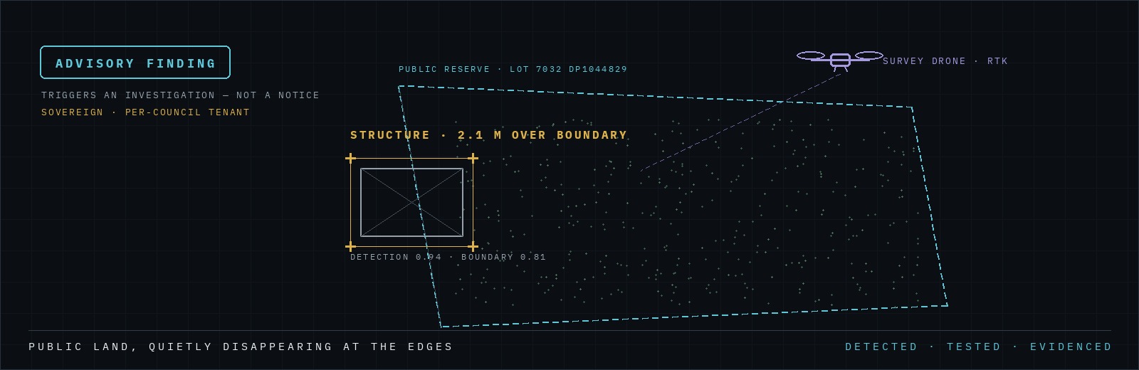
Work in progress — an early demonstrator we’re sharing to show where we’re headed.
Every council in NSW owns land it struggles to keep an eye on: reserves, road reserves, drainage corridors, bushland. Over time that land quietly disappears at the edges — a shed over the boundary, a back fence pushed into the reserve, a driveway sealed across the road reserve, fill and green waste dumped on public ground, vegetation cleared without consent. Individually small; collectively a steady erosion of public land, ratepayer value and environmental protection. Today it’s mostly found by chance, by complaint, or by a site visit years too late.
This is one of the problems we’re working on with councils right now. Land Encroachment is a new module on the Edgegenix platform, and below is an early look at how it comes together end to end.
Walkthrough · a drone survey plays through the console: the map tracks the flight, the system pauses on each finding — shed, hardstand, fence, dumped material — and an on-screen assessment checks it against the council boundary. Near the end, a LiDAR view reveals a structure hidden under tree canopy.
Setting expectations: this is a concept demonstrator, not a finished product. The detections in the video are pre-baked and illustrative — they show the workflow, not a trained production model — and the LiDAR under-canopy view is a roadmap capability shown for illustration. We’d rather show you honestly where we are and where we’re going than oversell a demo.
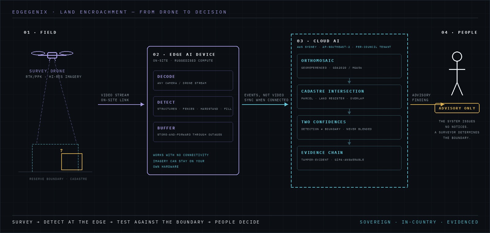
The pipeline · detection happens in the field; the boundary test, evidence chain and tenant isolation happen in the Sydney region; a person makes every call.
Because a camera can’t see through tree canopy, our roadmap adds LiDAR — laser returns that penetrate foliage gaps to reveal structures hidden beneath the trees that photogrammetry alone would miss.
The value case is straightforward, and it compounds.
To make that concrete with deliberately conservative, illustrative numbers: a council holding a few hundred parcels of community and operational land, flying its high-risk corridors twice a year, would review more boundaries in a fortnight of flights than ad-hoc inspection reaches in years — and a single regularised licence, or one legal dispute avoided, can fund a season of surveys. Every council’s numbers are different, which is exactly the modelling we’d do with you in a pilot, on your figures.
Property and open-space managers who answer for the land register. Regulatory and compliance officers who need evidence before they act. GIS teams who want findings delivered in GDA2020, ready to drop into the systems they already run. And executives who have to defend both the budget and the decisions made with it. If one of those is your desk, this was built for you.
Here is what makes this defensible for government: the intelligence runs sovereign.
Council land data — parcels, land registers, survey imagery, findings — is sensitive public-sector information governed by NSW privacy and access law (PPIPA, GIPA). It cannot be shipped to an offshore, black-box AI. Edgegenix is built so it never has to be:
Sovereign AI is not a feature we bolted on. It is the reason a public agency can put this in front of its ratepayers and its lawyers.
Land Encroachment is an active work in progress. The workflow you see — survey → edge and cloud AI → cadastre intersection → advisory finding → operator review, all on a sovereign, per-council tenant — is the target we’re building toward with council partners now. We’re sharing it early because the problem is real and immediate, and because the councils we talk to would rather help shape the solution than wait for a finished one.
If you manage public land and this sounds like your problem too, we’d like to talk.
Edgegenix is a multi-industry operational-intelligence platform; fire and smoke detection is our lead module and Land Encroachment is the next. Each module runs as its own tenant with its own console and data.
A 30-minute briefing with your property, compliance or GIS team — your parcels, your questions, no obligation. We’ll walk the workflow live and model the value case on your numbers.